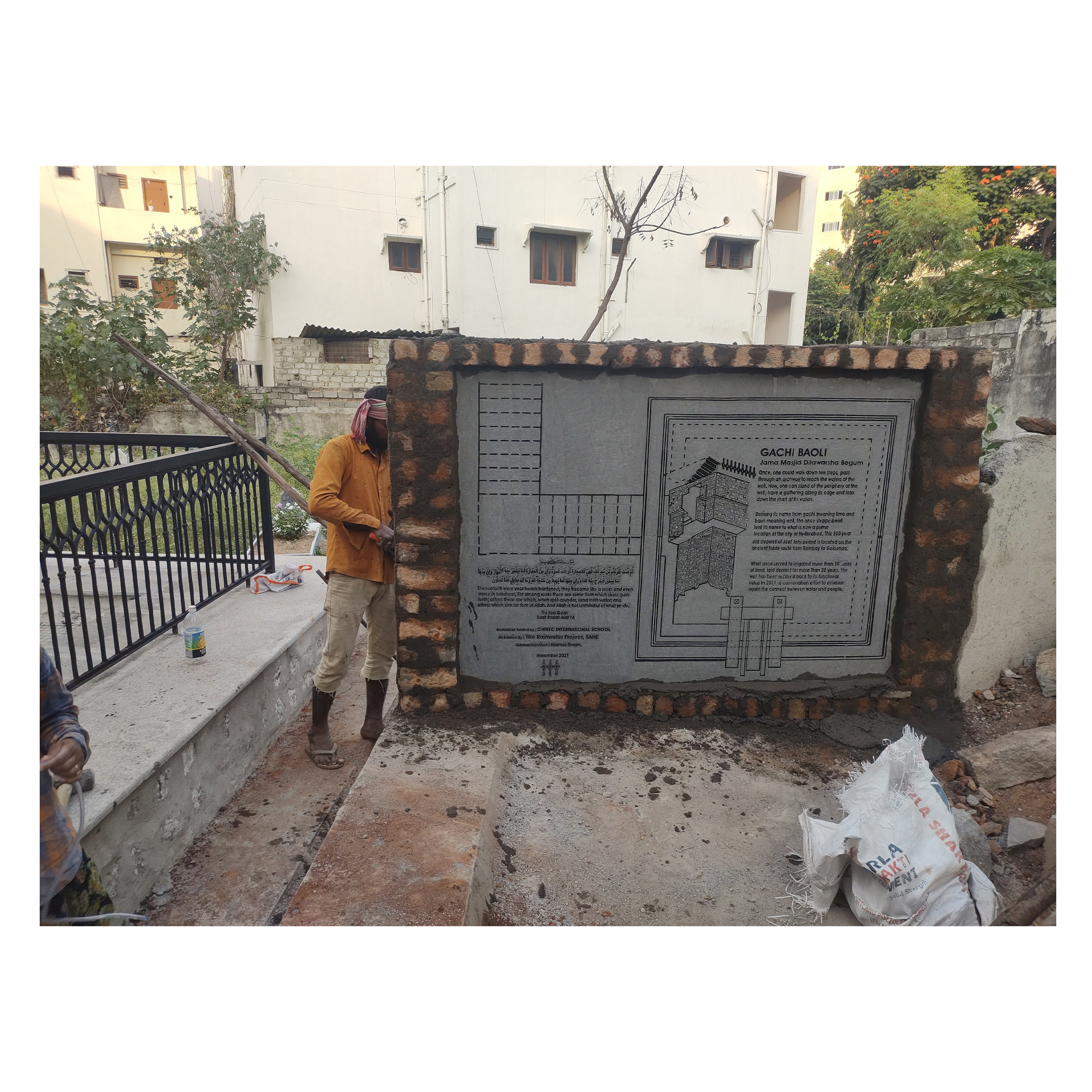
A stepwell, or baoli, is a subterranean edifice and water source. For centuries, stepwells—which incorporated a cylinder well that extended down to the water table—provided water for drinking, washing, bathing, and the irrigation of crops. The majority of surviving stepwells originally served a leisure purpose as well as providing water. This was because the base of the well provided relief from the daytime heat, and this was increased if the well was covered. Stepwells also served as a place for social gatherings and religious ceremonies.
The Gachi-Baoli well is contextually located in a necropolis abutting a mosque. The mosque is a prayer space to many local and migratory
populations from the neighbourhood and the graveyard is frequented by the family members who pay homage to their ancestors.A narrow roadway forms a main access to and from the inner residential spaces, which also connects them to the arterial Gachibowli Road. The well is built at an angle to the North-South orientation in the South-West of a graveyard, and is surrounded in the South-West by Jama Masjid-E-Dilawarsha Begum, a residence to the north-west, and a road to the south. The terrain along the sides of the well attributing to different land uses makes it a potential node.
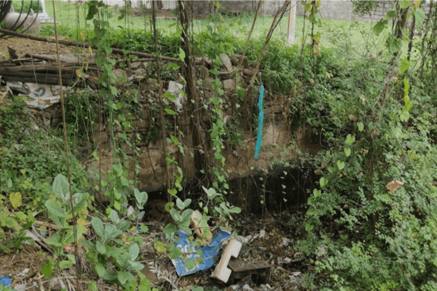
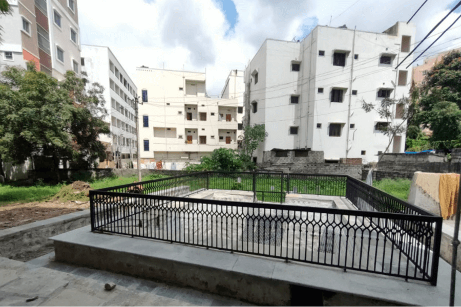

The well as found was hidden amidst debris and unattended growth of weeds and trees. Upon clearing the well boundary, the well shaft became visible, followed by the levels and the archway. Oral histories unravel a quarter-turn stairway from the arched opening to the cement pathway located to the south of the well. The well is a 19’-6” sided almost square structure, with slight shifts in the overall form attributing to the differential thrust over time. The shaft is 17’ at the inner sides, reducing to 16’8” at 9’-3” from below the ground level and further reducing to a width of roughly 14’ at a depth of 15’-5”; then continuing into a rock base. Also upon desilting a flat arch was uncovered spanning 3’-1” across extended lintels spaced over a 4’-8”opening supported on pilasters extending from the well shaft having a base at a 1’ wide platform at all sides along the well shaft, at 15’-5” below ground level. The arch is a simple rectangular form with tripartite division at the keystone which stands at a height of 12’-10” from its base. At the ground level, towards the North-East, two granite posts along with supporting posts extend into the well, to have once supported an active water-drawing mechanism. The structure
is built with dressed stone and lime plaster, and has an active aquifer which was identified by an old member of the neighbourhood, at the edge of the base rock. Other possible aquifers are waiting to be awakened.